
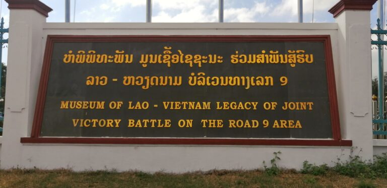
Tales from The Ho Chi Minh Trail – Operation Igloo White
Electronic Warfare On the Ho Chi Minh Trail – Igloo White
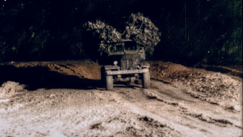
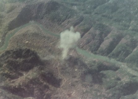
The war against the trucks on the Ho Chi Minh trail was an intense one. Day and night Fighter planes would be called in to hit targets on the trail, causing huge disruption to the supply line. The NVA though were masters at hiding the trails under the Jungle canopy, which made spotting trucks very difficult. Special OPS would do trail watching, but it was extremely dangerous. Enter operation Igloo White. Comments below from Mark.
The jungle canopy was a hindrance to identification, the photo interpreters could identify activity without seeing it. At the onset of the dry season (i.e., the end of the southwest monsoon), trucks would begin to move and that ever-increasing movement naturally caused clouds of red dust to rise into the air. (You know well the color of the soil.) Eventually that redness began to appear when the dust settled on the tops of the canopy and was easily distinguishable from the prevailing green. This was confirmation of activity under the jungle canopy. SECONDLY, the OV-1 Mohawk aircraft equipped with infrared (IR) capability could detect truck engine heat in concealed truck parks if the canopy was not overly dense. THIRDLY, some of the early parachute-suspended acoustic sensors were dropped in dense jungle canopy. They were capable of hearing voices, truck engines, and other human and mechanical sounds. We often requested the dropping of such acoustic sensors in canopied areas that were suspect.
With all the electronics at the Americans disposal, they came up with an an idea. They would drop listening devices (code name Igloo White) that would lay on, or bury themselves into, the ground. Then, they would listen to them from planes above.
It worked, but the NVA also knew of them. There were stories of the NVA playing games with the listening devices. It’s claimed they would move the devices, or have trucks drive in circles around the sensors indicating a large convoy in the area. These claims are not verified, Mark Explains below…
As to NVA counter-tactics. To be effective, seismic sensors were employed in strings of 4 to 6 on open roads (i.e., not concealed) that were straight or relatively straight for a minimum distance. Assuming that the sensor survived impact (the usual case), the more of them and the closer they were to the road, the results could be quite good. If the NVA had located and removed one of the four to six sensors, it would have been readily noticed in the computer-processed printouts. Finally, assuming they knew where several sensors in a string were located, they would never have attempted to drive trucks around them during the day (way too easy to be seen). At night they used the trail to move supplies and in the darkness it would have been extremely difficult to be driving in circles, especially where the roads were narrow and the area littered with bomb craters. Finally, in the book “The War Against Trucks: Aerial Interdiction in Southern Laos 1968-1972,” there was no reference to or mention of such NVA counter-tactics. Occasionally, one sensor in a string would become very active even during the day, and this was attributed to run-away activity and not NVA counter-tactics.
Occasionally, one sensor in a string would become very active even during the day, and this was attributed to run-away activity and not NVA counter-tactics.
I was lucky to meet Mark on a trip down the trail together in 2019. We drove over the area of coverage on the Ho Chi Minh Trail that he listened to, so to speak. We had a great time although it wasn’t very long, I very much enjoyed his company. He had many stories to tell me…
I was a target analyst in the ISC at NKP. I was not one of the aircrew. However, that said, I did fly with them on two occasions – once in January 1969 out of Korat RTAFB and once in February 1969 out of Utapao RTAFB (the wing was temporarily transferred to Utapao while the runway at Korat was being lengthened). Both times, I flew the night-time (18:00 to 06:00), race-track orbit on the south side of Route 9 from southeast of Tchepone (Sepon) to south east of Khe Sanh in South Vietnam.
“ Prior to January 1968, when the seismic (mainly) and acoustic sensor program went live, Road Watch Teams comprised one source of intelligence (aerial reconnaissance and photo-reconnaissance being two other sources) of activity on the Ho Chi Minh Trail in Laos.
[Note: Igloo White, the sensor program, was based in the Infiltration Surveillance Center (ISC) at NKP RTAFB.]
The CIA, to my knowledge, sponsored two major programs in Laos:
- Project Momentum – the Hmong guerrilla fighters in northern Laos (the CIA’s flagship project) that were supported by the CIA’s Air America and the USAF, and
- Project Hardnose – the recruitment of Lao tribesmen into teams to watch the roads on the Trail.[Note: There were other lesser projects such as Pincushion and Hotfoot.
Commencing in 1963, the road watch team project received assistance and training from the Thai PARU (Police Aerial Resupply Unit) and Royal Thai Special Forces (RTSF). There were at least two training facilities inside Laos – one on the southern part of the Trail not far from Houei Kong (to the east of Pakse), and another on the northern part of the Trail located to the northeast of Savannakhet (east of Thakhek).
This effort was largely replaced in 1968 by the sensor program”
There were two main organizations involved in the real-time collection and analysis of sensor-derived intelligence of the Ho Chi Minh Trail in Laos.
-
Collection and transmission – the “Bat Cats” of the 553rd Reconnaissance Wing (EC-121R aircraft – later replaced) stationed at Korat RTAFB. The seismic and acoustic sensors were all battery-operated with UHF/VHF line-of-sight transmitters. Terrain masking (i.e., karst and mountainous features) prevented direct transmission from the sensors to the ISC. Thus, the need for an orbiting aircraft. The EC-121Rs also had a limited capability to analyze data in the event that (a) the ISC-based IBM main-frame computer was down, or (b) the ISC was unable to receive data from the orbiting aircraft (14-hour missions – one hour out, twelve hours on station, and one hour back).
-
Receipt and analysis – operation Igloo White located in the Infiltration Surveillance Center (ISC) at NKP RTAFB. Each sensor (development at the Sandia National Labs in New Mexico, manufactured by Sylvania, Magnavox, and others, and tested at Eglin AFB in Florida and in Panama) had its own two-digit frequency and two-digit tone code identifier (e.g., sensor 02-13 at geographical location XD12596076 in string 07-1). Each sensor’s data was received, processed, and correlated in an IBM main-frame computer located in the ISC and the results were printed. For each seismic sensor, the printout revealed the number of seconds of activity in each minute of time expressed as a number between 0 (not active) and 9 (highly active). Target analysts then reviewed the printouts to determine activity – the size (i.e., number of trucks), speed, and direction of movement.
Sensor Drops
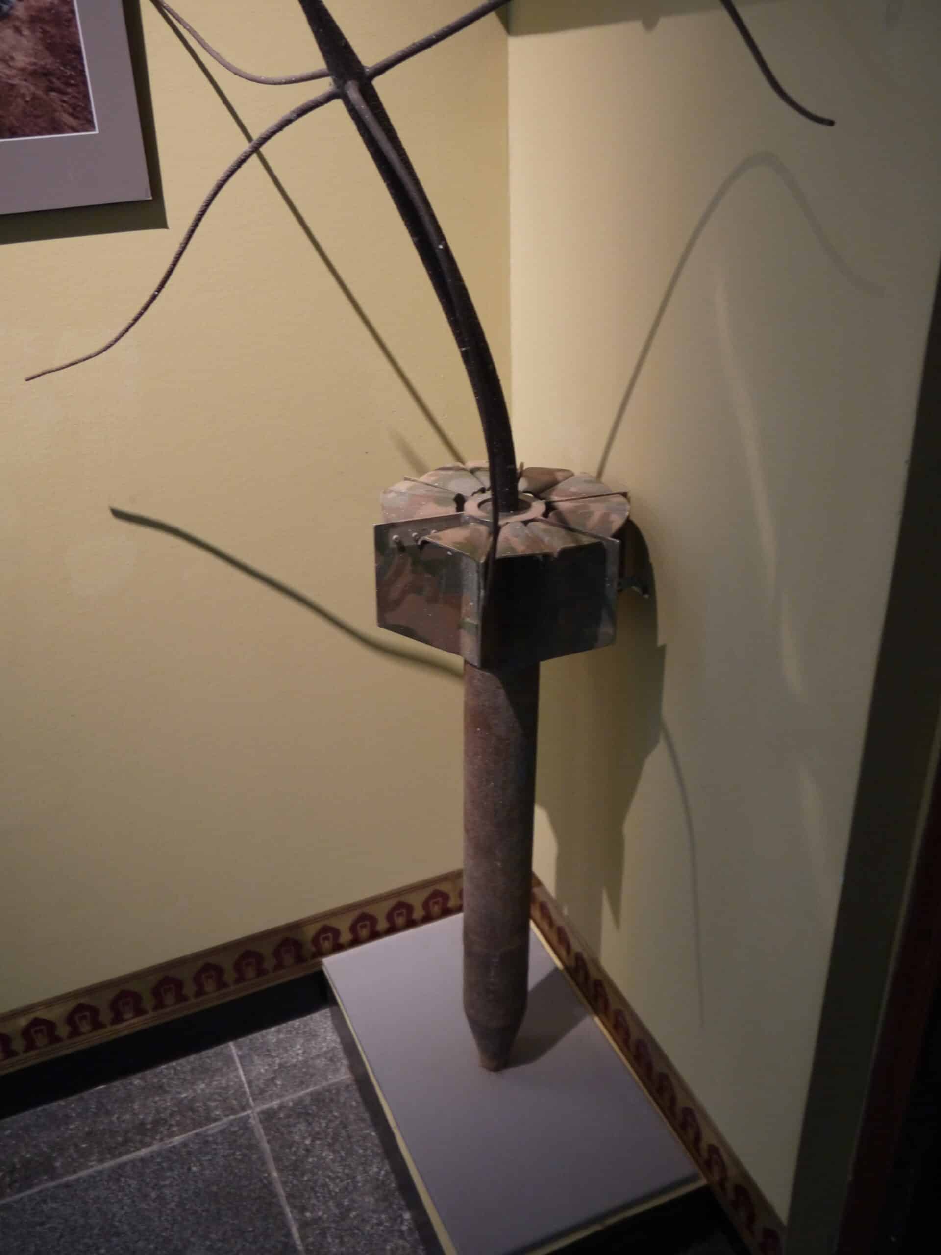
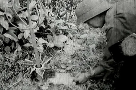
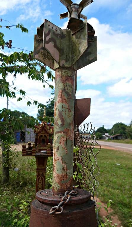
The sensors were dropped from planes, and this type would bury themselves up to their top and look like a small tree. Once in the ground the sensor would go to work. Other types disguised as dog turds would lay on the ground and listen, although this is not confirmed.
I do not think that they were ever used in the Igloo White operation (in 1968-1969 covered the area from from Mu Gia and Ban Karai passes south to Muong Phine and southeast to Tchepone and route 9 approaching the border with South Vietnam). I had close contact with the photo interpreters that updated our maps with sensor locations. All of those were of the ADSID (Air Delivered Seismic Intrusion Detector) type and were carefully plotted based on photo and other information supplied by the dropping aircraft. While the PSIDs were hand placed, I never knew or heard of any extensive use of hand-placed sensors on the Trail, especially the heavily used roadway segments. In more remote areas that was certainly a possibility. In the book “Force Recon Command” by Alex Lee (US Marine), the author describes missions conducted by 3rd Force Recon Company in 1969-1970 on that part of the Ho Chi Minh Trail in the Ashau Valley of South Vietnam. Although trucks were sighted and/or heard, he makes no mention of employing any sensor-type devices.
“The operational life of a sensor. In 1968, when the ISC went active, the battery life of a sensor was +/- 90 days. In 1969 (or possibly late 1968) they began using long-life batteries which raised the operational life to +/- 120 days. When sensors in a functioning string were about to expire, a new string was dropped on the same route segment and plotted on our maps. In those cases, there might be 8-10 sensors in the string operating and, one-by-one, the older sensors would expire until only the newly dropped sensors were active. Based on information fed into the computer, all of this was updated in the printouts. This, of course, raises another issue about the NVA finding a sensor and employing counter tactics. While they might find the technology to be useful, if the sensor’s battery had already expired, the removal of the sensor would not have impacted the detection effort”.
Another gentleman contacted me with the information below. Thanks John.
“The sensors are dropped from 2000 ft, at an air speed of 508 mph Air speed. They fall so they are 80 yards apart, which gives the AC130 a decent target area to take out more equipment and personnel. The sensors were also dropped from Helicopters.”
“I was responsible for the safe resurgence of using the sensors more during my tour in SEA 1972. The security module was made of C4 when I got there and several F4s were lost due to premature explosions of sensors being delivered by them. From an Aircraft Radio background, I proposed on day 1 there that it be replaced by an electronic circuit that would make the Sensor codes be destroyed if the enemy dug one up. It was successful and became the total replacement of the old C4 model.
What a surprise to hear that sometimes retrieval missions were in the cards….
“Well it was a mission to retrieve the sensors built without codes or protection from enemy stealing our technology. No camera brought along. I’m sorry but it was rushed as quickly as possible to avoid enemy contact. Unfortunately they were closer than we thought because once we got airborne and I was told I could practice flying this Huey is when a burst from a hand held weapon killed the pilot instantly leaving me panic stricken and unsure of where I was heading.”
Updated Oct 2021
https://en.wikipedia.org/wiki/Operation_Igloo_White
Enjoy this post? Find the rest of our Ho Chi Minh Trail Tales here. Interested in riding in Laos, but looking for more adventure and less history? Check out our Laos ADV Tours page.

April 1967 I arrived at NKP Naked Fanny, air force base thailand in northern part of this country, I was a security policemen. Igloo White plan was building a place for Computer to listen to the information given to computers , with trained AIR fORCE staff with language skills of all the common spoken in this area of southeast asia, the location area where sensors were dropped, then staff would transmit information to gather from any language heard from sensors, and figure out where to send planes to bomb or shoot at what set off sensor a vehicle or troops and supply for enemy in south vietnam viet cong or nrvn operations in the south. HO CHI MINH TRAIL IN LAOS WHERE things were try stop all movements on trail. sometimes the planes had sucessful stopping what set of the sensor, trucks and other transport were destroyed. one thing stopped. until another sensor kick off signal that some thing else is trying movement down the trail.
WAYNE W. HOGSTAD SGT 56 SECURITY POLICE SQ 1967-1968
Thanks Wayne…
Hi Wayne, thanks for the message, do you have any pictures we can add to the story’s?, be great to add them to this post. Always good to hear from those who where there…thanks for taking the time…
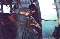
I was a instrument systems technician assigned to the 8th TFW in Ubon, Thailand from 1970-71. One on the main duties I performed on a nearly daily basis involved configuring the F-4Ds to drop these sensors. I was given a listing of tail numbers and the timing required for the intervalometers for the mission. The speed of the aircraft, combined with the pulses from these devices , determined the spacing of the sensors. I had to first extract the units from each aircraft, then return to the shop. Using a digital counter I made the minor internal screw adjustments to get the timing correct for the upcoming missions. Once reinstalled I moved on to the next aircraft. I often had a dozen or more to do each day.
Thanks for you post..
Served at Ubon RTAFB in Thailand 1969-70. I worked on the f4Phantom and AC-130A Gunships as a Mechanical Accessories mechanic. Heating,AC,Pressureizing,Anti-G,Oxygen,Canopy Seal. I was able to observe 2 or 3 times Phantoms with the tree-like sensors mounted on both wings. At the time I didn’t know what they were used for. They were light brown from what I remember. Pointed on the bottom they were probably weighted so they would stick in the earth. They had tree-like branches without leaves. Appeared to be two or three mounted on each wing. I was thinking why have tree’s mounted where the bombs usually rode. It was about 20-30 years before I found out they were Aquabuoy sensors. So it looks apparent that Ubon was also involved in the planting of the ‘tree’s on the trail. NO photos.
Many thanks Glenn, happy to receive your information…
I was station at NKP, Task Force Alpha in 1970-71. Worked in the computer room and ran all the reports from the night action. Left there and went to Eglin AFB Florida and stayed there for 43 years, I now live up in Leesburg Va.
Retired AF.
Charles Tom Black
Many thanks Tom..
Thanks for looking…
To the thehochiminhtrail.com webmaster, Keep up the great work!
Many Thanks..
Many thanks
I WAS THERE AND GOT SHOT BY A SNIPER ON THE HO CHI MIN TRAIL WHILE PUTTING OUT GROUND SENSORS. I NOW HELP VETS GET TO 100% DISABILITY.
Thanks for commenting, care to tell us the story to add to this page. Many thanks
Worked at Bein Hoa AB in 1969-70 with DART 1, a mobile deployable sensor read-out site. Worked with BatCat EC-121T on missions over southern Laos. DART used sensor data to provide target info to Army artillery. We broke down a lot of trucks on the HCM trail and made a lot of holes in the jungle.
Thanks for the info about TFA.
Jack Lyons, Det. 2, 504th TASGp 1969-70
Many thanks for commenting..
Very informative article. I am wondering if ground troops could have tapped into the signals transmitted by these sensors. My uncle was assigned to 2/27 HHC in the 25th Infantry Division in 1967 and 1968. He was stationed at the Cu Chi Base Camp. He told me his job was to go out on patrols and use a “receiver type device” to “listen to personnel movement.” He doesn’t remember a whole lot about it but I’m trying to satisfy my own curiosity about his service and learn more. He said he was lucky that he had to be flown in and out because he had to get new batteries to use the receiver. Although he was attached to long range patrols that usually lasted a long time, he never had to spend more than a few days outside the wire on these patrols because of the batteries. The only picture I have of his time in Vietnam, he is sitting on what first appears to be an upside down 55 gallon drum cut in half, but if you look closer, you can see latches used to keep the container closed. He said it was part of the “listening device,” but couldn’t remember much more than that. One time when I was maybe 10, we were walking in some fresh snow and he told me the crunch sound of the snow compacting under our feet reminded him of the sound of troop movement through the listening device. Any information would be much appreciated. I am reluctant to ask him for more details about his service because, even though its been almost 60 years, he still won’t talk about his time in Vietnam.
Thanks for the information, very intersting..